Spring Disappearance and Backyard Flooding? A&S Researchers Explore if Climate Change and/or Human Intervention are to Blame
A faculty and student team from the Department of Earth and Environmental Sciences is installing urban stream monitoring stations to investigate how extreme precipitation and other factors are affecting a Syracuse waterway.

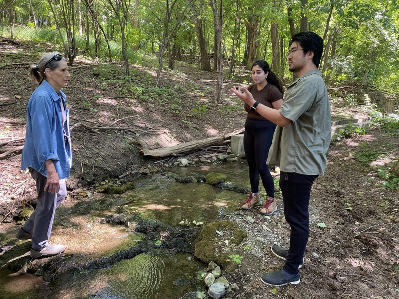
From left to right, Kathleen Stribley, Aamna Khan ’26 and EES Professor Tao Wen discuss waterflow as they stand beside City Line Brook in Syracuse’s Valley neighborhood.
Global warming and climate change are changing the future of rainfall as we know it. In the Northeast United States, the warmer temperatures and increased humidity has led to a roughly 60% increase in the number of days with extreme precipitation over the past 50 years, according to the Northeast Regional Climate Center. In communities like Syracuse’s Valley neighborhood, these rains pose risks when it comes to flooding as some springs and brooks run directly through residential areas.
As extreme weather events increase, it is essential to track urban watersheds to help safeguard residents and inform policy makers about potential hazards. To do this, College of Arts and Sciences (A&S) Professors Tao Wen and Aaron Mohammed, from the Department of Earth and Environmental Sciences (EES), have teamed up with community members who live near City Line Brook. Since stream neighbors want to protect the watershed but are also impacted by flooding, they sought out Wen’s assistance in recent years.

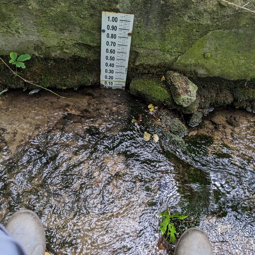
After noticeable stream loss since last fall, neighbors Kathleen Stribley and Eric Fabio, a plant biologist consultant, began periodic stream flow monitoring. Wen and Mohammed's project will build on their efforts with the installation of permanent urban stream monitoring stations in the City of Syracuse’s Valley community to collect critical baseline data on water quality and quantity in City Line Brook. A local community group - Tomorrow’s Neighborhoods Today (TNT) Valley Section - assisted with the project’s grant application.
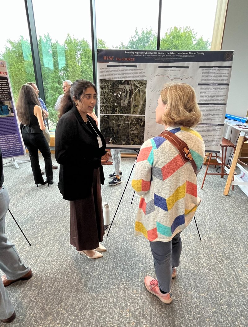
With support from the Department of Earth and Environmental Sciences, the Engaged Humanities Network’s Engaged Communities program in A&S, Syracuse University’s Women in Science and Engineering program and the SOURCE, undergraduate student Aamna Khan ’26 is also collaborating on this project. Throughout the spring and summer, Khan has worked with Wen, Douglas Wood, a research analyst in EES, and Stribley to monitor several locations along City Line Brook for water quantity and quality and also surveyed the stream for the upcoming installation of water sensors to collect real-time high-frequency water quality data. She presented her research at the SOURCE summer symposium on August 8th.

Aamna Khan, a junior triple majoring in environmental geoscience, sustainability and policy, and history, presenting her team’s research at the SOURCE symposium. (Photo courtesy: Tao Wen)
Why are urban streams at risk? Urban streams generally have highly compromised or no riparian zones (land along the side of streams) compared with streams in unimpacted natural areas, which if present, would facilitate uptake and degradation of some pollutants. In addition, during precipitation events, urban streams might also be overfilled leading to urban flooding, which poses a threat to property.

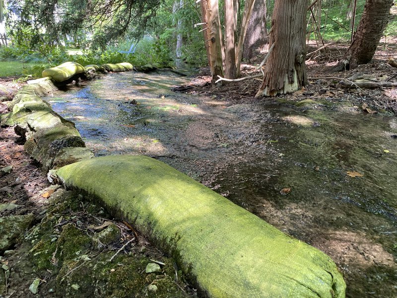
Impacted Valley resident Anita Sterns has placed sandbags along portions of City Line Brook to help protect her property from flooding during extreme rainfall events.
Feast-or-famine in City Line Brook. While extreme rain events have increased in recent years in Central New York, the water quantity in City Line Brook has surprisingly decreased by and large since last fall. Urban streams like City Line Brook have several environmental benefits, such as mitigating urban heat. The team is working with local resident Kathleen Stribley, who is a Professor Emerita from the SUNY College of Environmental Science and Forestry, to understand whether climate change or other human caused factors are at play when it comes to the decrease in water flow. Conversely, when extreme rain events occur, the banks of City Line Brook often flood, presenting a threat to neighbors’ properties throughout the community. By studying how the brook reacts to heavy rainfall, this project can provide critical data to local city planners so they can make improvements to the watershed.
Watch the following video to learn more about the team's work.
What can be done to alleviate the flood threat? Wen recommends redesigning the flow channel to accommodate peak flow conditions. This will ensure that water can be efficiently transported without endangering residential properties near the brook.
Featured
Tao Wen Assistant Professor: Hydrogeochemistry, Environmental Data Science, & Noble Gas Geochemistry
Aaron Mohammed Assistant Professor (joint appointment with Civil and Environmental Engineering) Hydrogeology
